A course-first GPS experience
Grassy started with a simple idea: the golf courses you play deserve a real place in your golf story. Course GPS extends that idea into the round. Your map, scorecard, rankings, lists, and course history now live closer together.
Course GPS is currently labeled “GPS Beta” in the app. No GPS subscription is required: all current Course GPS Beta planning tools are included for everyone. Detailed geometry, weather, terrain, and green data still vary by course and conditions.
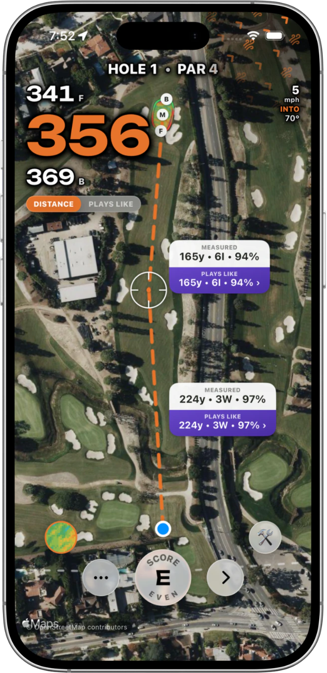
Map, yardage, and score on one screen
The main round view combines a live satellite map with front, middle, and back yardages and your scorecard. You can stay oriented without bouncing among separate screens for every decision.
- Switch between measured and plays-like distance. Plays-like adjustments use available wind, elevation, temperature, and altitude.
- Drag a target to any layup or hazard point and see golfer-to-target plus target-to-green yardages.
- Use adaptive distance arcs to read useful landing zones at a glance.
- See club suggestions when your bag is configured.
See the hole from more than one angle
Move between an overhead view and a 3D flyover to understand shape and strategy. On supported courses, interactive 3D terrain adds another way to inspect the hole before choosing a line.
Supported courses can also include LiDAR Green Books with slope heat and break-direction arrows. These details are not universal, so Grassy shows them where supported rather than promising the same layer everywhere.
Keep the context that matters during a round
Course GPS keeps more than the next number in view. You can review your own history on the hole, set today’s pin, optionally auto-advance while you walk, add notes, and see weather when it is available.
The scorecard remains part of the same round flow, keeping the hole map, yardages, and score close together.
How to start a GPS round
Open a course where GPS is available in Grassy, start a round, allow location access for live distance, and enter the map view. Course eligibility depends on the scorecard and traced geometry available for that course.
Because Course GPS is in beta, the clearest feedback is specific: name the course, hole, and what did not look right. That helps the map improve without making broad coverage claims the product cannot yet support.